
Blog

Explore how coordinated drone swarms are revolutionizing large-scale surveying, agriculture, and disaster response operations across India.
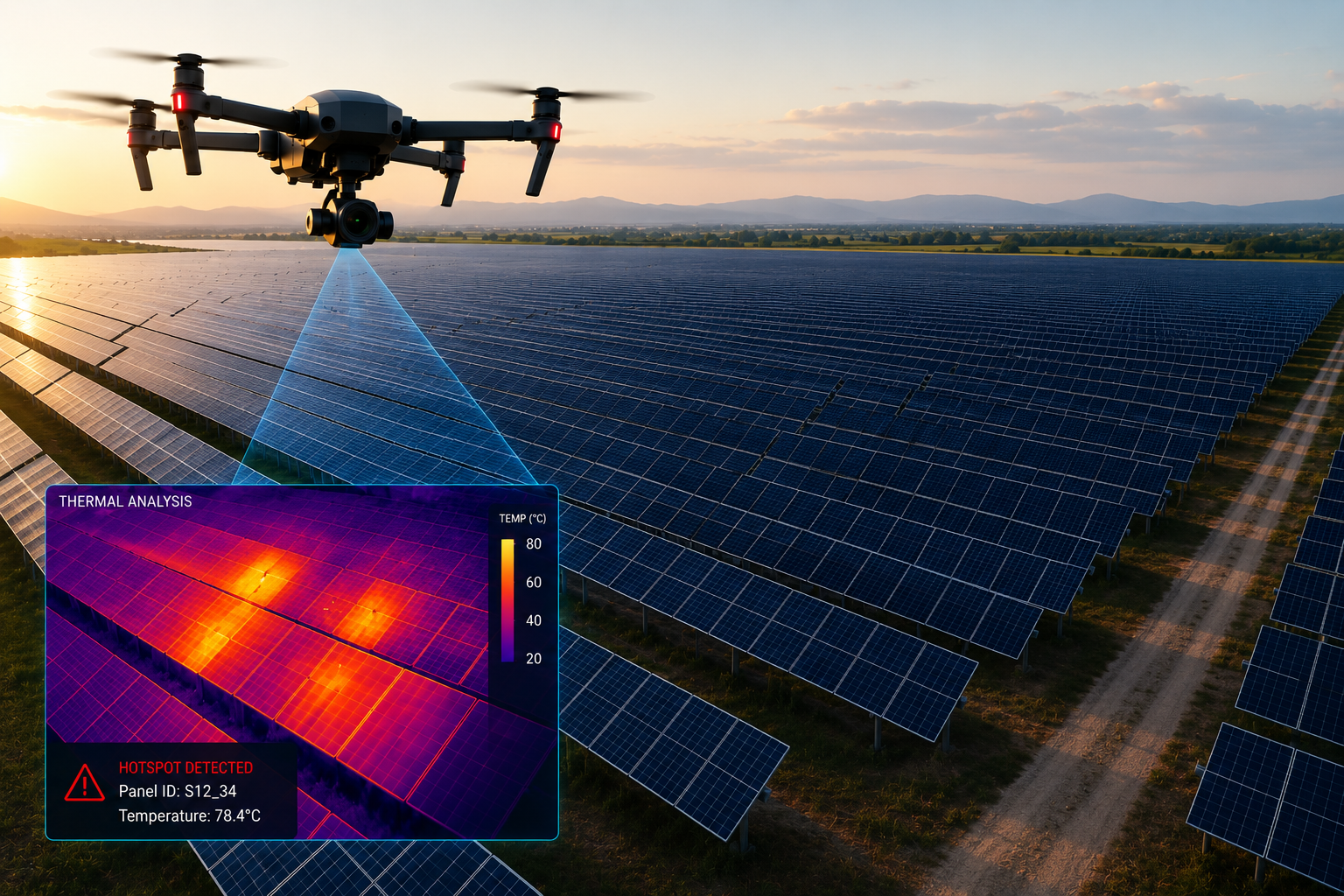
Thermal imaging drones can detect faulty panels 10x faster than manual inspection. Learn how solar farms are cutting maintenance costs.

How NDVI mapping and precision spraying are helping Indian farmers increase crop yields by up to 30% while reducing input costs.

As drone usage grows, so does the need for security. Discover the latest counter-drone technologies protecting airports and power plants.

A comprehensive guide to India's drone regulations, NPNT requirements, and how to ensure your drone operations are fully compliant.
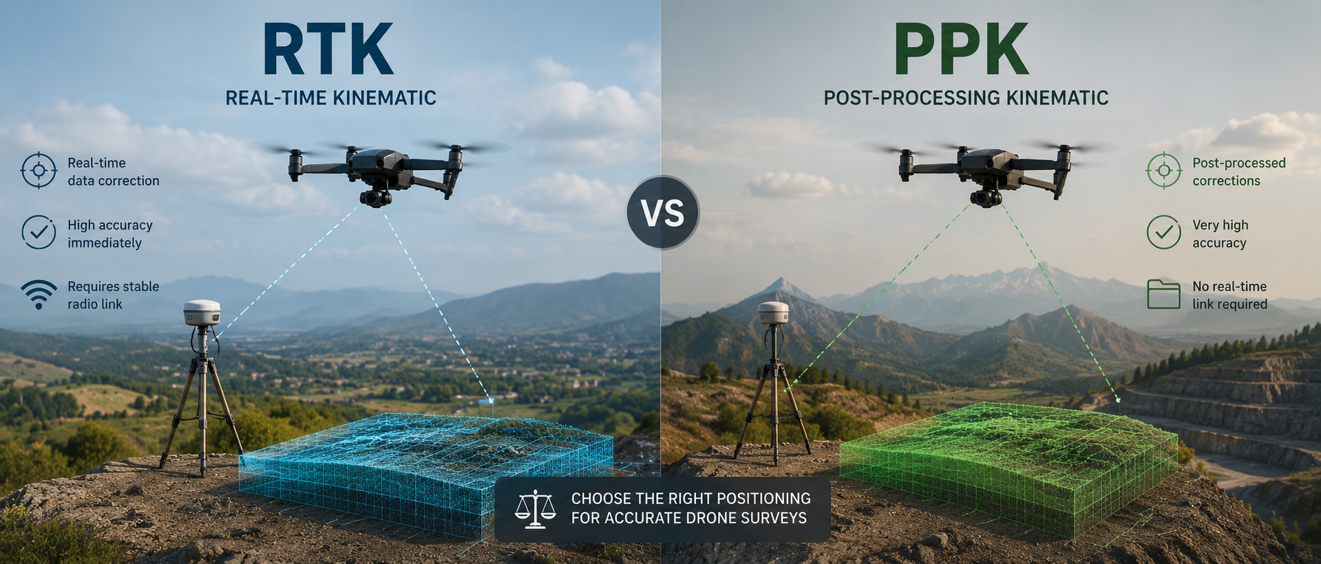
Real-Time Kinematic vs Post-Processed Kinematic — which gives better accuracy for your land survey project? Here's a detailed comparison.